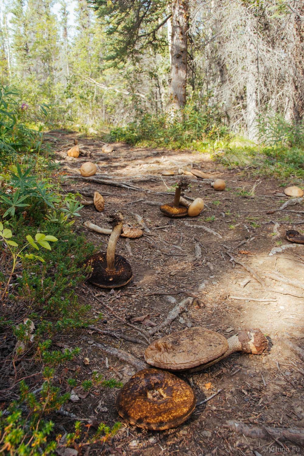
Auriol Trail, Kluane National Park, Yukon
While Auriol Trail isn’t one of the best hikes in the park, it sure felt nice when we completed the 9 mile roundtrip hike in less time than it had taken us to finish some of the other shorter length hikes we’ve done in the area.
The hike stayed in the boreal forest for the most part. After being spoiled with treeless views quickly into all of our other hikes, it was strange remain in the trees.
I referred to the hike as our mushroom hike because of all the different mushrooms we kept coming across, along with sections of trails being littered with them. Sadly we don’t have any knowledge about wild mushrooms to forage for them.
But we did figure that despite the large, meaty looking mushrooms being so enticing, they most likely weren’t edible because they all remained on the trail even though the parking lot was full of vehicles whenever we drove past.
With an elevation gain of only 1,300 ft., the trail remained sub-alpine, although it did eventually open up in a meadow providing a wide, albeit hazy, view of the Auriol Range (a different angle of it than from our boondocking site). There was a backcountry campground at this halfway point of the trail with 4 tent sites. Although we didn’t find the hike itself very exciting, this would’ve been a nice place to spend a night sleeping in our tents.
Backcountry cook area.
We came across some park rangers working on the trail in this section. One of them said that people get confused in the section by the creek about where the trail goes so they added this trail border.
What the heck is 111 KM away?! We couldn't figure out this trail marker and even asked one of the park rangers that we came across who said he has no idea either!
According to the hike information handout we received from the Kluane National Park visitor center, Auriol Trail is a common access route for hikers interested in going deeper into the Auriol Range and climbing Quill Peak, Martha Black and other unnamed peaks.
The trail on our way out became really marshy and wet. Jerud tried to keep his feet dry but I gave up and just walked through water - which was actually refreshing.
The Kluane National Park visitor center is located inside the Haines Junction visitor center. It has some wonderful informational visual displays about the park and is worth setting aside some time to spend there.
There are several factors that make Kluane National Park unique. The bi-national park system that is made up of Kluane National Park (Yukon, Canada), Wrangell-St. Elias National Park (Alaska, US), Glacier Bay National Park (Alaska, US) and Tatshenshini-Alsek Provincial Park (British Columbia, Canada) was declared a UNESCO World Heritage Site in 1979 for its glacier and icefield landscape. They are also important habitats for grizzly bears, Dall sheep, and caribou.
Kluane National Park is home to about 2,000 glaciers. Over 100 of those glaciers are surging glaciers, which are capable of advancing up to 1,000 times faster than normal. This creates a chaotic jumble of collapsed ice pinnacles and crevasses. Surging causes the landscape to dramatically change. One of the displays at the Kluane National Park visitor center says that surges can last up to a year or two and then remain stagnant for 10 to 50 years. Unfortunately for us, except for a handful of its smaller glaciers that we could see on mountains from our hikes and drives, we weren’t able to see the park's larger glaciers. Those are further in the backcountry. Kaskawulsh Glacier is one of the park's more accessible glaciers via a multi-day backpacking trip. We unfortunately couldn’t make it happen. There's no way we could board Tybee or leave her with a dog sitter at her age.
After our time at Kluane National Park, we came to realize that the park would be best experienced if we were able to venture further into its backcountry. And of course a plane ride or two would round out the experience nicely. As I mentioned in my King’s Throne post, there are certain parts of the park that are only accessible via plane or boat. Yukon is truly remote and so much of it remains wild.
View of glaciers from Sheep Mountain.
So back to Auriol Trail – bottom line is if you only have time to do one hike in Kluane National Park, don’t spend it hiking Auriol Trail. (Sorry trail!) King’s Throne or Sheep Creek Trail would be my picks.
We were in the Kluane National Park area from July 25 - August 9, 2016.


